Cathedral Range
SATURDAY 26TH TO SUNDAY 27TH SEPTEMBER. 1998
PLANNING
I have hiked many times through the Healesville and Mt. St. Leonard areas. and I have been told how nice the Cathedral Range was to hike through. Due to this. it had been an objective of mine to hike there at some time. I started by obtaining a map of the area. but due to the Cathedral Range’s location, I had to make do with a tourist map. This map was quite recent. so I would have no trouble with tracks and camping grounds. After planning the route. it was to be that the first day would be the more interesting and challenging day. while the second day would be the hike back to the car. I needed three other people so as to make the hike legitimate. but due to commitments. My sponsor, Phil, was not able to make it. Instead, Paul Mishura agreed to come along, and as the only rover on the hike, was acting sponsor. After a ring around, I was finally able to bring Matt Le and Emily Tham onto the team as well. Mainly owing to the time of year, no one else was able to attend. Alter talking with the leaders, we were able to borrow two tents and Trangia stoves from the Venturers at Scotch, and Paul picked these up on the Friday before the hike. Due to my lack of transport, I had to obtain the food a little in advance. so this was bought the weekend prior.
COMMENCING THE HIKE
We had arranged for Matt to pick me up at 8:30am in Clayton. and for the rest of the team to then meet at his place at 9:00am. By the time we all met. and the food. stoves and tents had been distributed, we were running a little late to set off. We reached Healesville by mid morning. and dropped off at the Police Station to give them a copy of the planned hike. the list of team members, and emergency contacts if needed. We then continued on our way to Sugarloaf Saddle, the south point of the Cathedral Range. This would be the starting and finishing point of the hike.
DAY ONE
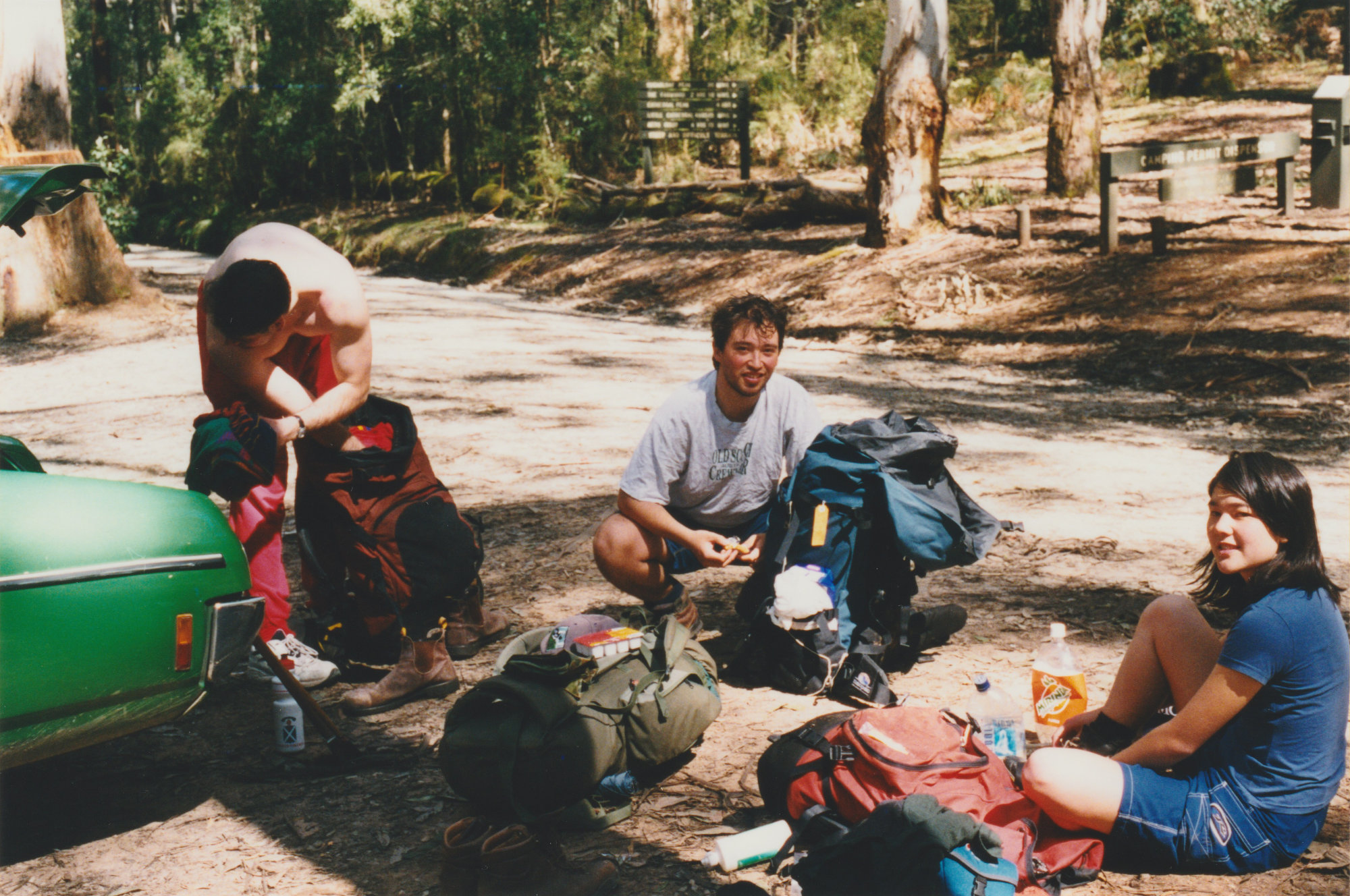
We arrived at the car park in Sugarloaf Saddle, where Paul parked his car. After we had made final adjustments to our hiking gear (while Paul showed off his muscles – see image below) we set off for the top of Mount Sugarloaf.
The track wound its way through beautiful Mountain Gums, and with blue skies above us, it was the perfect day to hike. We hiked steadily around the side of Mount Sugarloaf, but slowed as the gradient became more challenging. After a while we came to a part of the track that went straight up! Yes, l had been told that you are required to do some rock climbing on the way up, but as it was only dirt to grab onto, the climb looked rather daunting. There was. however. a rock face to the east of the track, which looked like it led up the side of the mountain. l did take photos of the hike route, but as you will find later, there were problems with my camera.
We progressed up the side of the mountain, practically rock climbing on a 50° angle. As it was on an uneven rock surface, it was quite strenuous on our legs and ankles. so we had to make sure that no one injured themselves. Once we reached the top of the face. hopeful as we were. there was still no sight of the top of Mount Sugarloaf. After about 2 hours of steady hiking (or should I say climbing) we finally sighted the top and. once there. settled down for a long rest! We also had the privilege of meeting the locals, as the resident koala was out and about. On my spare camera l was able to take the photo of the koala. and one showing Paul. Matt. and Emily all not paying any attention to one!
After we had taken a short break, we journeyed on to get as far through the planned first day as possible, before taking the lunch stop. We continued north down the other side. which was worse than the way up! We were climbing down large boulders. and at the same time, trying to keep to the track. It was between Mount Sugarloaf and The Razorback that we stopped for lunch. As I was carrying most of the lunch gear, was quick to unpack to keep lunch short. It was at this time that l went to change the film in my camera, only to find there was no film in it! As it was my father’s camera, a misunderstanding had occurred, and I had been quite content in taking some great shots without any film. I quickly loaded the replacement film and took a few shots. which can be seen on the next page. The first photo is of Paul and Emily – Paul at the time was checking the Football scores with my portable radio, and as it was Grand Final day, I had made sure that the radio was packed! The second photo is of Mount Sugarloaf. We actually hiked down the jutting rocks you can see on the side of the mountain. The third (and fourth) photos were of the magnificent view that we had during lunch. This was just one of the many great views at which we were able to marvel, during the trek on top the Cathedral Range.
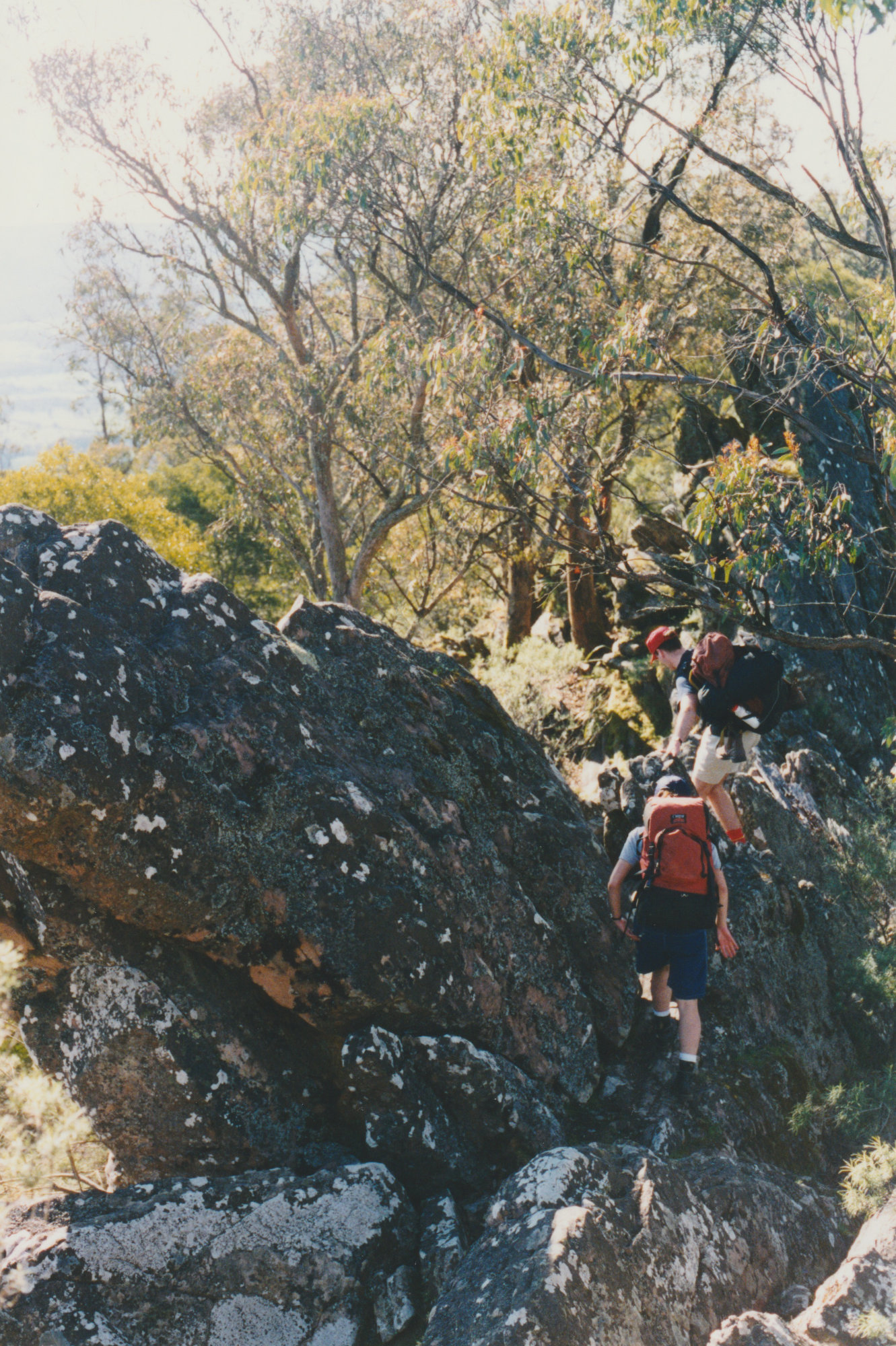
After we had had a break, and lunch was packed up. we continued north along The Razorback. It was here that I found out the reason for its name. As you can see below, our progress was made challenging by the natural formation of the rock face.
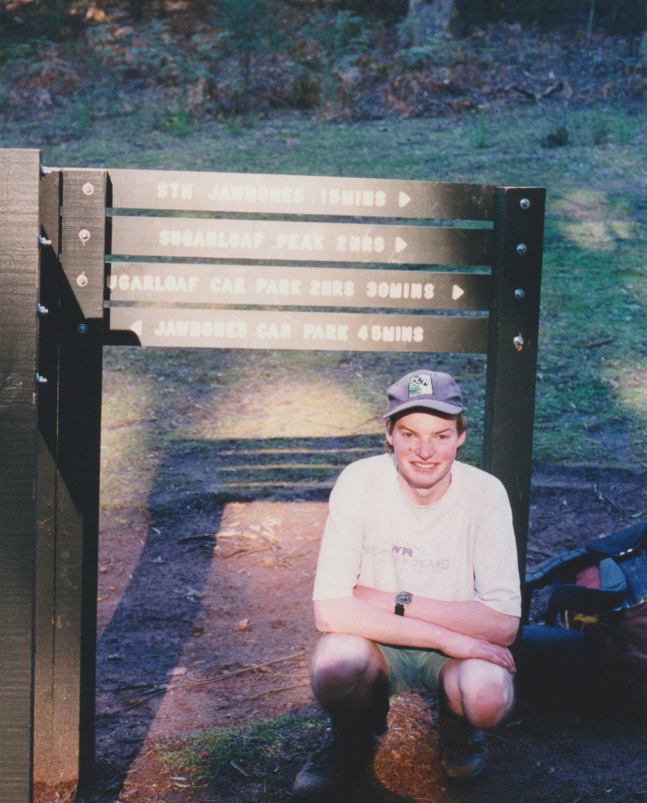
It was late afternoon by the time we made it to The Farmyard. so we didn’t stop for a long break. There was a creek some distance down the hill, so Paul went to restock his water supply. It was at this time of the hike that we made the decision not to continue up to The Cathedral and Cathedral North, as the light was fading. We then re-planned the hike to go on a more direct approach through Neds Saddle. to Neds Gully, as this was where we were to camp. Before we left The Farmyard. I decided it was time for me to get into a photo, and this can be seen below.
We took the first turn off towards Neds Saddle. and gradually made our way down the side of the mountain. The terrain was much more open than the earlier hiking. as can he seen in the photo also on the next page. All but Emily enjoyed the downhill slope of the track. as her feet were hurting from the rocks earlier on in the hike. It was early dusk when we arrived at Neds Saddle. so we knew the right choice had been made. After finding the correct path to follow. as there were about 6 or 7 to choose from, we set course for our final destination for the day, Neds Gully. As the light faded around us. we walked into a lush. tropical environment as we entered the valley, and enjoyed the steep downhill of the track leading us to the campsite. The area we hiked through was quite clayey, and many trees had fallen down due to recent rain. These trees in some places blocked the path, and on occasion, flattened other small trees in the vicinity.
It was dark when we arrived at the site, and to our surprise. the campsite was nearly full. After some time trying to find a safe place. the tents were finally pitched. We then started to arrange dinner. and as there were no spare fires available. we had to ask other campers if we could share their fire. They agreed, and shortly after retired for the night, so we were able to cook at our leisure. As the hiking had been very challenging and tiring, we all had an early night.
DAY TWO
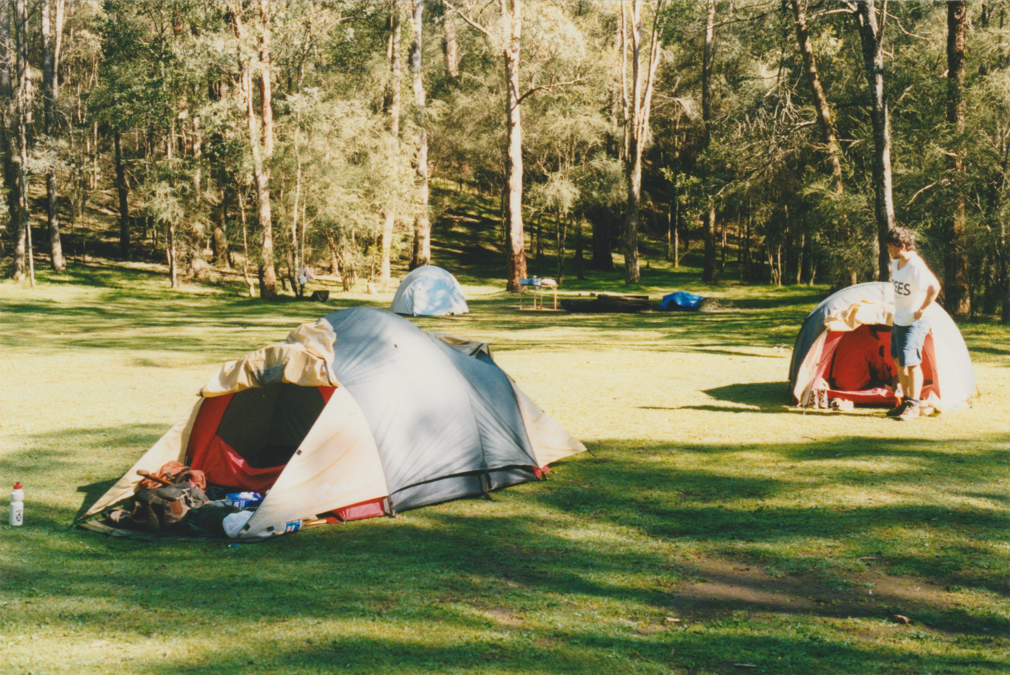
We woke at dawn and enjoyed a pleasant morning in the warm sun. The photo above is of our camping site for the night. After a quick breakfast, each tent pair set about packing their gear and taking the tents down, and we were soon ready for the trek back to the car.
We set off south along the Little River Walking Track, which lead to Cooks Mill, as shown on the next page. This led us through some lovely scenery (except when we went through the pines). When we reached Cooks Mill. we had a brief stop to have a quick drink and continued up the walking track, bypassing Jawbones Carpark.
After following the track southwest, and crossing Cerberus Road several times, the track eventually stopped and we turned onto the final stretch of the hike – up the mountain back to
Sugarloaf Saddle.
This was probably not the most difficult part of the hike. but as we were all tired from the previous day’s challenge. the slow and tedious track used up any leftover energy we had. The view we had of Mount Sugarloaf when we neared Sugarloaf Saddle is one to be remembered. I have included a photo below of the last stretch of the hike along Cerberus Road, on our way to Sugarloaf Saddle. As we were all tired and eager to make it back to the car, we used the map and our position with reference to Mount Sugarloaf to estimate the distance to the carpark. We were surprised when we reached the carpark far sooner than expected. Once we arrived back at the car (to our delight) we rested, and made the most of being in the area. We packed the car and headed home, stopping at McDonalds for lunch on the way.
SUMMARY
If I were to complete the hike again, it would have to be in the form of a day hike. The fact that we tackled Mount Sugarloaf and The Razorback with full hiking packs is where the hike became difficult. Also, the fact that we started later than expected raised the dilemma of reaching The Cathedral with daylight to spare. The main difference I would make when hiking there again would be to travel light. I would only carry first aid gear, food for lunch, and water. This would enable a fast and efficient hike speed over Mount Sugarloaf, and across The Razorback, giving enough time to reach The Cathedral and Cathedral North with daylight to spare.
Even though we had a relatively inexperienced hiker in the team, on a very rigorous hike route, all members of the team completed the hike successfully. I would, however, not recommend this hike for inexperienced hikers if hiking with a heavy load. In my belief, I would say that when travelling light, this would be a highly recommended and highly enjoyed day trip.